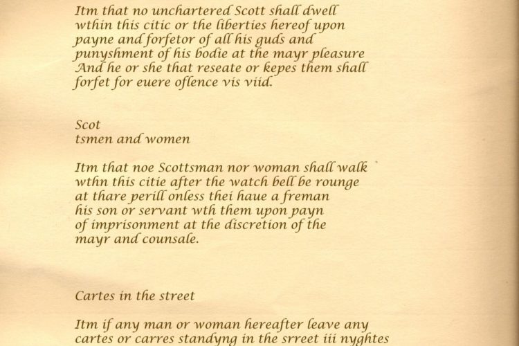
Unlawful Games 59- Item, if any person or persons suffer hereafter any unlawful games to…
The East March of England
The East March of England
Map of the East March of England; boundaries and generalities.
The English East March is the northern part of Northumberland. It borders the Scots East March to the north where the river Tweed defines the frontier. To the west there is a boundary with the Scots Middle March but the southern boundary is uncertain. In the 16th century the east Borderers were of the opinion that the Water of Ale was the division but in the 1570’s the March Warden, Hunsdon apparently took the Aln as the boundary.
The Governor of Berwick was also the Warden of the East March. In the 16th century there were “many small castles and piles” in the East March intended for defence against sudden raids but many of the inhabitants, seeking peace and quiet, left them to decay and moved away from the frontier.
The East March was smaller and far less populous than either of the two Scots Marches that bordered it. The Tweed was fordable at many points and the flat countryside adjoining Scotland made the East March vulnerable to incursions by the Scots. The country on both sides of the Tweed was fertile and the farmers do not seem to have raided each others lands but the thieves of Teviotdale raided both.
Three of the most important Northumbrian strongholds were on the frontier of this March, Berwick, Norham and Wark. The fortifications of Berwick were modern and in good repair but throughout the 16th century the defences at Wark and Norham were in decay and a miserly government was reluctant to foot the repair bill.
Related Posts