Unlawful Games 59- Item, if any person or persons suffer hereafter any unlawful games to…
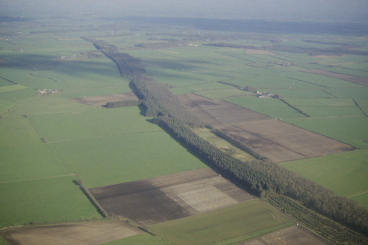
Scots Dike Aerial View
Aerial Photograph of Earthwork called Scots’ Dike which marks the Scotland / England frontier in 16th century Cumberland and Dumfriesshire
The only section of the Anglo-Scottish Border in the west that does not follow a natural feature is marked by the earthwork known as the Scots’ Dike. It was built across the Debatable Land to mark the frontier and runs more or less east to west for about four miles between the rivers Sark and Esk.
In the 16th century the land of this region offered few identifiable features which could be used to define a border. Much of the ground was bog and marsh land and the course of the streams and the location of the bog ponds could change over time. There was danger that local disputes about the line of the border could lead to skirmishes and these skirmishes could escalate into conflict between the nations.
The solutions to the disagreements about the line of the border were to ask the French Ambassador to arbitrate about the line of the border and then to dig a ditch to define the line of the border. The remains of the ditch can be seen on this aerial photograph where it runs through a narrow plantation of trees and terminate in the east near the Scotsdike Hotel.
Location: Dumfries and Galloway, Dumfriesshire
OS sheet: 85 NY362736
Related Posts