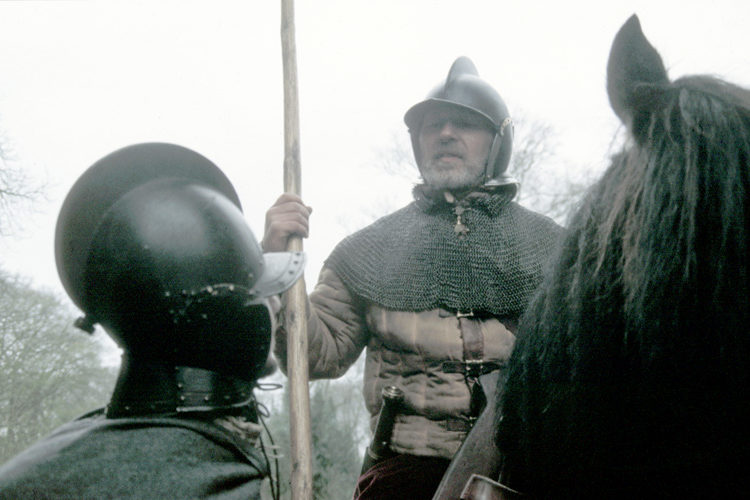
The 'Peaceful Persuasion' And Transplanting Of The Marchmen By James VI Scotland & I England/Scotland…
Reiver Routes
Reiving Routes
The following text is from text in the Callendar of Border Papers and dates from the 16th century. It gives an impression of the routes that Reivers may have taken on their raids to steal cattle and any other goods that were available.
A ‘Raider’s Line’ is given as from Carham on the Tweed to Chollerford via Harbottle. Doubtless for an army equipped with ordnance good roads, passes, and gaps through the hills are of first import¬ance, but the raiders on their little horses, and knowing the moors very well, were able to ‘run their raid’ and ‘drive their prey’ by tracks right across the fells.
1. Why would the Reivers not follow the main highways? One thought is that Reivers always keep to the crown of the hill.
2. Why might this be a good way to travel and navigate?
3. Are there any disadvantages to travelling on the tops of hills?
Again, take the following passage from Musgrave’s report on the Border riders to Burghley in 1583 and you will find another route given for Liddesdale.
‘When Leddisdall people make anie invacions to the Fenwickes, they goe without (viz., outside, or east of) Bewcastell xi or xii myles, and goe by the Perlfell without the Horses heade nere Kelder, and so alonge abone Chepchase.
‘When they goe to the water of Tyne (viz., the South Tyne), they goe by Kyrsopp head, and without the gele Crage, and by Tarnbek and Bogells gar and so alonge by the Spye Crage, and the Lampert, and come that waye.’
4. Many of the places mentioned in this letter are visible on a map. Draw them on the map at the end of the worksheet.
Sir John Selby writes to Burghley a few years later—the Liddesdale men rode also into the East March—
’ These Liddesdale men are the most disordered of all the Border, they come in great bands through Tevedall and the Marc (Merse) into these East marches, and return with their booty quietly the same way, without resistance, for they have no warden to answer for them by Border Law.’
There was an old Border proverb concerning the men that dwelt within ‘the swyres’ of the Liddel, which was evidently drawn from bitter experience, for ‘to ride night and day like the Liddesdale men’ was a common expression.
5. What did this phrase mean, and why did it strike fear into people?
There were along the Middle March alone no fewer than forty-four ‘passages and byeways for the theefe,’ wherein is set forth a ‘breafe of the bounders wayes and passages of the Middle Marche all along the border of Scotland, beginning att Chiveat hill being the lemyet of the Easte Marche and ending att Kirsop the bounder of the West Marche of Englande.’
See No. 853, Calendar of Border Papers, I 597,
Reiving Routes WORKSHEET 2
The following information describes possible routes taken by Reivers.
1. Use the information on this and the preceding page to see on modern maps the routes that may have been taken.
2. Then plot the routes on the maps at the end of this worksheet.
Northumberland / Scottish Borders
Cocklaw
From the Bowmont Valley by Cocklaw to the Alwin. This route was called Hexpathgate in Medieval times
Dere Street
Section of the Roman Dere Street used in the Middle Ages when it was known as Gamelspath. Crosses the Border frim England into the Kale Valley
Redeswire
From the Jed Valley via the Redeswire into the Rede Valley
Windygyle
From the Kale Valley via Windygyle to the head streams of the Coquet
Bloody Bush
Another high level route between Liddesdale and Tynedale
Scottish Borders
Peebles – Annandale / Nithsdale
From Edinburgh this route pierced the gap between Moorfoot and the Pentland Hills and, bypassing Peebles, leads, either to the upper waters of the Annan and Annandale or, by the Well Path, to Nithsdale and Dumfries
Thief’s Road
Up Manor Water, across the head of Meggatdale, and over the Strypes past Herman Law, the Pike, the Black Knowes, and Tudhope Fell, to the head of Billhop Burn and the Water of Hermitage
Yarrow / Moffat
A road from the headwaters of Yarrow to Moffat Water
Weddale (Stow)
From Edinburgh this route took advantage of of the Fala Moor gap between the Moorfoot and the Lammermuir Hills and passes into the Tweed Valley by Weddale (Stow) and Gala Water
Soutra
This route was by Soutra and the Leader. The Soutra route was known as ‘Malcholmisrode’ and sections of it probably followed the line of the Roman Dere Street
Wheel Causeway
Passes from the upper reaches of the Jed into Liddesdale and gives access to the upper waters of the Kielder at Deadwater
Jed / Liddesdale
Southern routes, of prime strategic importance to both countries in their military campaigns, linking: Lochmaben to Roxburgh Castles / Carlisle to Berwick-upon-Tweed
Cumbria / Northumberland
Bewcastledale Waste
Frequently used route between Liddesdale and Tynedale / Allendale
Dumfries & Galloway
Eskdalemuir
From the Tima to the White Esk
The Thieves Road in Liddesdale.
The Thief’s Road or Thieves Road starts in Dumfriesshire and travels through to Liddesdale and north to Jedburgh. It passes Hermitage Castle at the head of Liddesdale and is though to be the road travelled by Mary Queen of Scots on her way to see her lover and future husband at the Hermitage.
It is called this name because it was a favourite road of the Reivers who would take their stolen cattle through the wild countryside to hidden valleys until the pursuers had given up their chase. The right of the pursuer to chase after their property was given in the Border Laws or Leges Marchiarum and the immediate pursuit was called the hot trod.
The pursuers would often be accompanied by sleuth hounds and a survey of the borders in the period by Timothy Pont / Gordon notes the high value given to sleuth hounds. In the dead of a winter’s dark night, it would be nearly impossible to track the quarry over the countryside.
Record ID V1123
Search these resources for maps, Pont Blaeu, Marches
Related Posts

This Post Has 2 Comments
Comments are closed.

I notice on your map that the Stranraer and Portpatrick area doesn’t seem to be included. Is this because they weren’t involved in Reiving or some other reason?
Only the border area between England and Scotland is considered in this project. Maps of the area that were published in 1645 from notes taken in 1580 – 1610 will shortly be included and will include some of the area around Stranraer. An Ordnance Survey map was made that shows a lot of the relevant sites but Cardoness Castle at Gatehouse of Fleet is the most West.
Peter