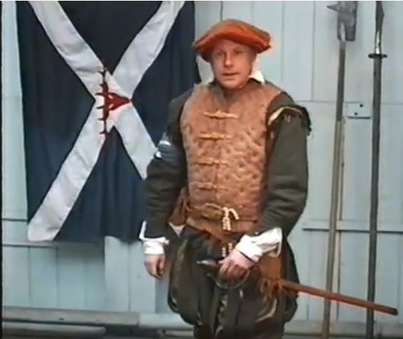
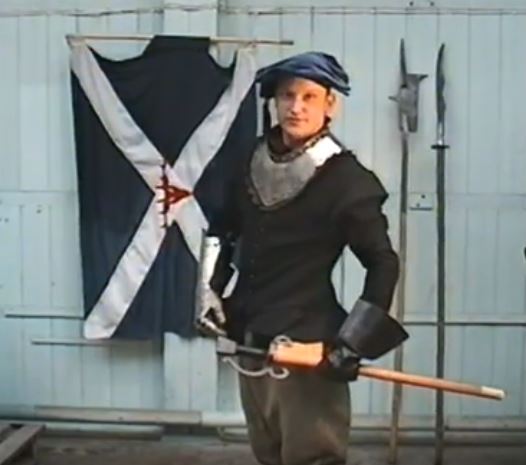
Reiver the wardens headman with swords
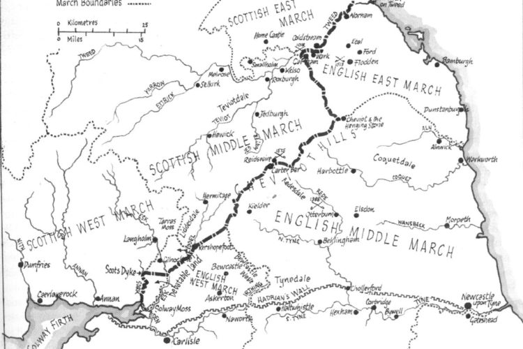
England and Scotland were two fiercely independent countries in 1500 - 1700 and the robbing, rustling and blood feuds in the lawless area between the countries was dealt with by creating March areas with a…
England and Scotland were two fiercely independent countries in 1500 - 1700 and the robbing, rustling and blood feuds in the lawless area between the countries was dealt with by creating March areas with a…
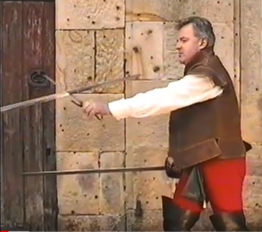
Swords and techniques used in 1500 - 1600 in the English Scottish border raids, skirmishes and wars where Border Reivers fought each other and fought for and against either side. A rapier, backsword made for…
A Reiver foot soldier introduces himself Scotland and England were in conflict in the 16th & 17th century so border raids, skirmishes and wars were frequent in this lawless land. Cattle rustling robbery and murder…
Border Reiver Name Locations On the Scottish Border the clan system was stronger than on the English side. Blood relationship in Scotland meant that loyalty was shown to the head of the family. This may…
WERE YOU A REIVER? Border Reiver Names Note that other names may be associated with Reivers For almost 400 years, from the early 14th century, the English and Scottish families fought a seemingly endless series…
Galloway description 1654 "The inhabitants engage in fishing both in the surrounding sea and in the rivers and lochs which flow everywhere below the hills; from these at the autumnal equinox they catch in boxes…
Sheriffdom OF Dumfries 1654 "on the sandbanks of the Solway, the arrival of salmon, they spur their horses into water, and with lances armed with iron points they easily spear and draw them out." The…
Nithsdale description 1654 "Nithsdale together with Annandale nurtures a warlike race of men, but they have a bad reputation on account of their raiding. For they occupy the sandy Solway Firth, through which they often…
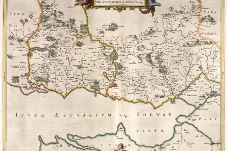
Annandale 1645 Map Annandale 1654 Map: Charting the Nation website National Library of Scotland: Annandale Map: Annandale Text The text explains the feuds of Johnsons Maxwells. Robert Bruce & Balliol is explained. This map shows south…
Liddesdale Description 1654 In Liddesdale rose up Hermitage, so called because it will at one time have been dedicated to the solitary life; but now it is a well-fortified castle, which belonged to the Hepburns;…
Teviotdale Description 1654 "inhabited by a warlike people, who on account of the very frequent wars in previous centuries between the Scots and the English, are highly prepared for military service and sudden attacks." The…
Tweeddale and the Province of Peebles 1654 "scattered by the force of the fish as they burst out, losing the footholds which they have endeavoured to make and strengthen for themselves. Nonetheless they catch in…
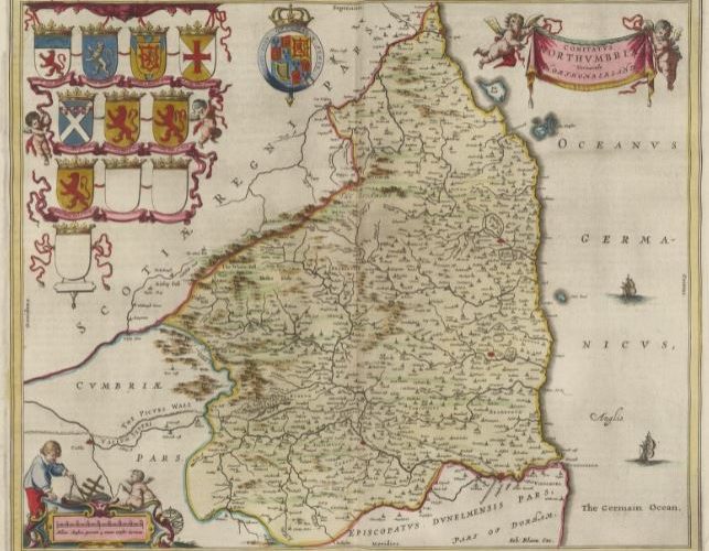
Blaeu's Atlas names Northumberland as North Humberland and includes the English Middle and East Marches. Based on notes and sketches 1580-1613 by Timothy Pont who travelled in Scotland and northern England. Although robbed and suffering…
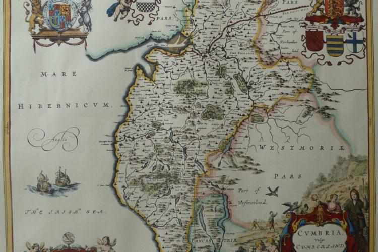
Cumberland 1622 map Based on notes and sketches 1580-1613 by Timothy Pont who travelled in Scotland and northern England. Although robbed and suffering in primitive conditions, his notes, updated by Gordon of Straloch, were the…
